
Local Trail Guides
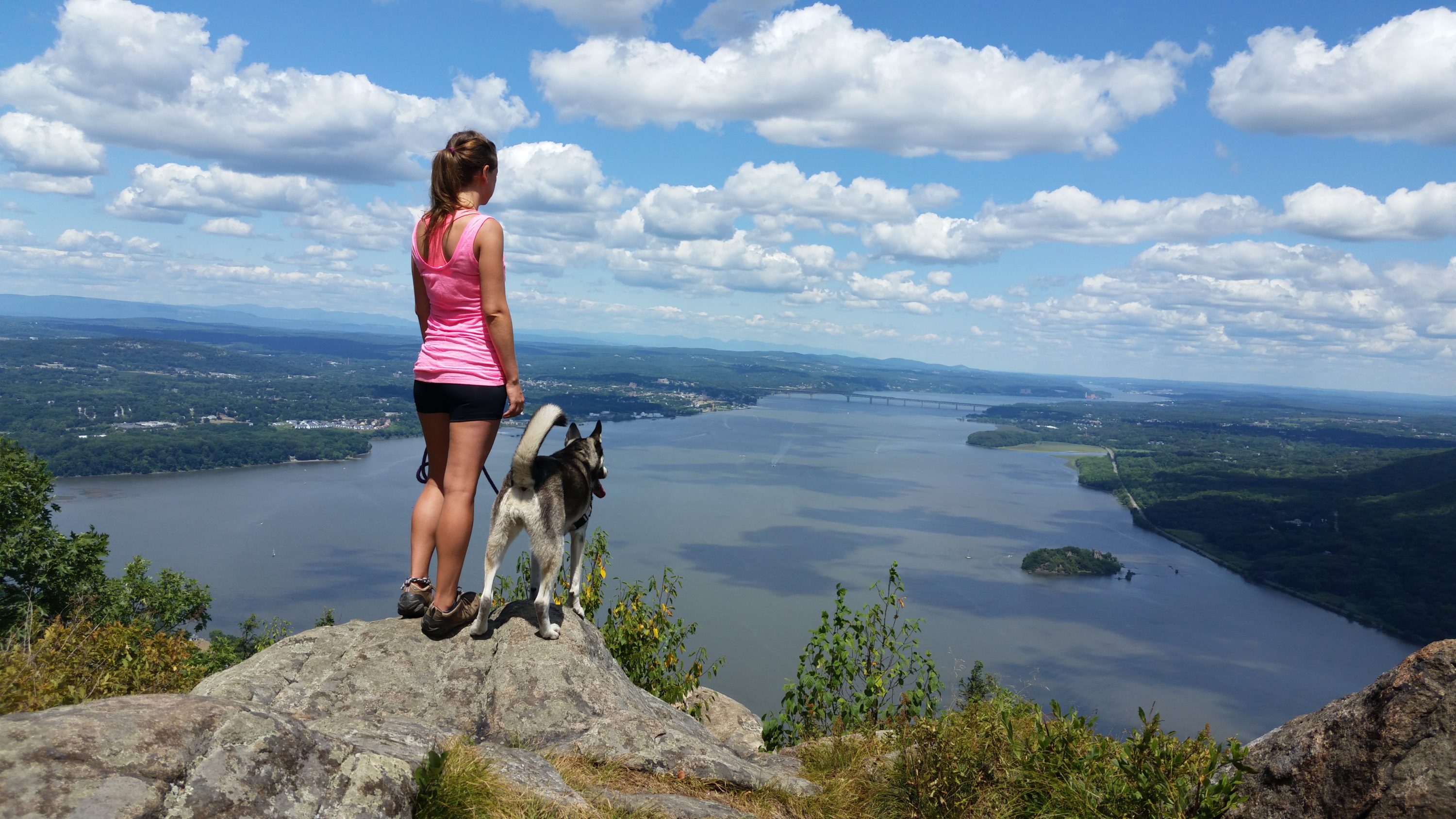
Storm King Mountain Location: Cornwall-on-Hudson, NY Length: ~2.5 Miles Difficulty: 6/10

Storm King Mountain is one of my favorite hikes in the Hudson Valley. It offers gorgeous views of the Hudson River with the Catskill Mountains in the distance, along with views of the amazing Bannerman’s Castle down below. Side note; If you’ve never heard of Bannerman’s Castle, do yourself a favor and look up the history, it’s an amazing story. Then I highly suggest taking the guided tours of the island, but that’s an adventure for another day! There are many different hikes on Storm King to explore, but my favorite, and one of the more popular ones, is to start from the parking area on Rt. 9W and ascend the Orange trail until it ends, then turn right on the Blue/Yellow Stillman trail which will take you to the gorgeous views I was boasting about. Then you can continue along and catch the white trail which will loop you back to your car!
Sam’s Point Location: Cragsmoor, NY Length: Variable; Up to 7.5 miles to see all the sights Difficulty: 4-6 Parking Fee: $10

Sam’s Point is one of those places I hesitate to write about because of it’s already large popularity. But it’s a place I feel I have to point out because it’s one of the most gorgeous places I’ve ever been. That being said, this is one of those adventures you should plan to start early or on a weekday, as there is limited parking and you will be turned away as parking on the road is prohibited. Okay, now for the good stuff. Sam’s Point has it all. After a short walk from the parking area, you find yourself at the top of one of the best lookouts in the area. No, it’s not exactly a “hike” to get to these views, which makes this place ideal to bring friends and family that may not be fit or physically able to complete a strenuous hike to see amazing views. (Part of why I love this place). After you take in the gorgeous views, you then get to play “Choose Your Adventure”. You can hike to the spectacular Verkeerderkill Falls (keep in mind these falls are seasonal, so they may be dry if you visit late-Summer), or head down to the super cool Ice Caves (see what I did there?). You could also decide to just do a simple loop around Lake Maratanza, the highest lake in the Shawangunk Ridge. Whatever you choose, I guarantee you won’t be disappointed.
Alander Mountain Location: Copake, NY Length: ~5.5 miles Difficulty: 8.5/10

So, this mountain has several different starting points. One of which may be a bit easier of a climb, but more ground to cover in the long run (about 8 miles). This particular climb starts out with a trailhead that is on a seasonal road. I have planned to do this trail in the early Spring, and have come across the road not only closed, but clearly still covered in layers of ice. So, I recommend the shorter, but more difficult path that leads you to breathtaking sweeping panoramic views. This is a blue blazed Alander Mountain Trail clearly marked from the road. Follow blue until you hang a left on the South Taconic Trail (white). Take this trail all the way to some amazing views. This is definitely a mountain worth checking out. I’d recommend downloading a good trail map, easily found on the Mt Washington State Forest website. There are many trails on this mountain, so have fun exploring!